Exploring Makueni County: A Map Through Time and Nature
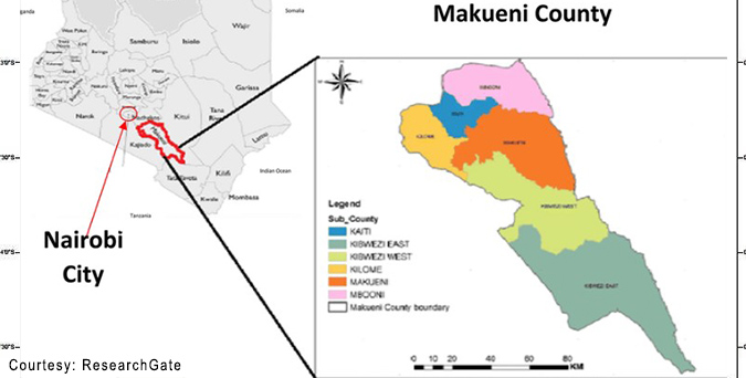
Makueni County, nestled in the arid and semi-arid zones of Kenya’s Eastern region, spans 8,008.9 km² and is divided into six sub-counties: Makueni, Mbooni, Kaiti, Kibwezi East, Kibwezi West, and Kilome. Each sub-county offers unique landscapes shaped by its geography. Makueni town, the administrative center, lies amidst modest hills, while Mbooni is characterized by the Mbooni Hills, which rise to 1,900m above sea level. Kaiti sub-county features the Kilungu and Iuani hills, providing picturesque views. Kibwezi East and West are known for their proximity to significant national parks and historical sites. In contrast, Kilome is famous for its unique agricultural practices due to its fertile soils compared to its neighbours.
Historical Attractions and Events
The region has a rich historical tapestry, with Kibwezi West being particularly notable for its historical significance. Kibwezi was one of the earliest interior destinations for slave traders and missionaries in the late 19th century, marking the beginning of European influence in the area. Key historical attractions include the Kibwezi ruins, which reflect the early missionary presence, and the cultural heritage linked to the Akamba community, known for their traditional dances, crafts, and oral histories. Events like the annual Makueni Agricultural Show showcase local agriculture and celebrate the area’s cultural heritage, providing insights into traditional practices and community gatherings.
Natural Wonders and Tourist Spots
Makueni is bordered by some of Kenya’s most famous natural reserves. To the south, it touches the Tsavo West National Park, known for its diverse wildlife, including the Big Five. With its volcanic origins, the Chyulu Hills National Park offers stunning views and is a haven for hiking enthusiasts. Within the county, attractions like the Makongo Forest in Mbooni provide serene nature trails where visitors can explore the local flora and fauna. Although seasonal, the Athi and Kibwezi Rivers are vital for the region’s ecology and offer scenic beauty. For spiritual and cultural tourism, places like the Kilungu Hills are revered for their ritual significance among the local communities.
Special acknowledgement goes to Surveyor M.N Omosa, whose contributions have been pivotal in mapping and surveying Makueni County. His work has greatly aided in understanding the geographical layout, facilitating development projects, and preserving the region’s natural and cultural landmarks for future generations. The detailed mapping efforts have made it possible to highlight historical, ecological, and tourist significance areas, contributing to educational and economic benefits for the region.
Therefore, the map of Makueni County serves not just as a geographical tool but as a narrative of its history, culture, and natural beauty, encapsulating the essence of this vibrant county.
Makueni County Map
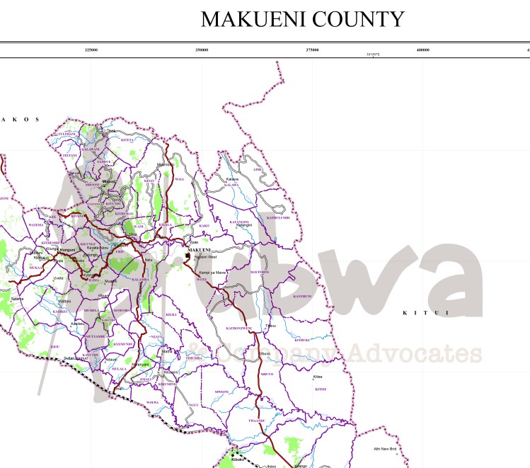
Download a detailed map with all features by clicking the below

Yuvenalis Kubwa is an advocate of the High Court of Kenya and a member of the Law Society of Kenya.